Introduction to Xining and Qinghai Province
Xining 西宁 is the capital of Qinghai Province in western China and when most people visit they comment on how clean the air is and how little pollution there is compared to the big megacities of eastern China. With over 300 days of glorious high altitude sunshine in every year, Xining is called the “Summer Capital” or 夏都 of China. With bitterly cold winters and perfect spring-like summers, Qinghai Province is open for exploration in the summer and this gives a great window into getting out of the city for some marvelous one day hikes.
Hiking Laji Shan
One of our most favorite local spots close to Xining is Laji Shan. Although the mountain does have the same pinyin spelling as the Chinese word for “trash” (垃圾)the actual characters are different and represent a transliteration of the sounds of the local Tibetan name for this place. This mountain, as one of the most rugged, pristine, open mountains in northeastern Qinghai is anything from trashy and has not been spoiled by either tourism or litter.
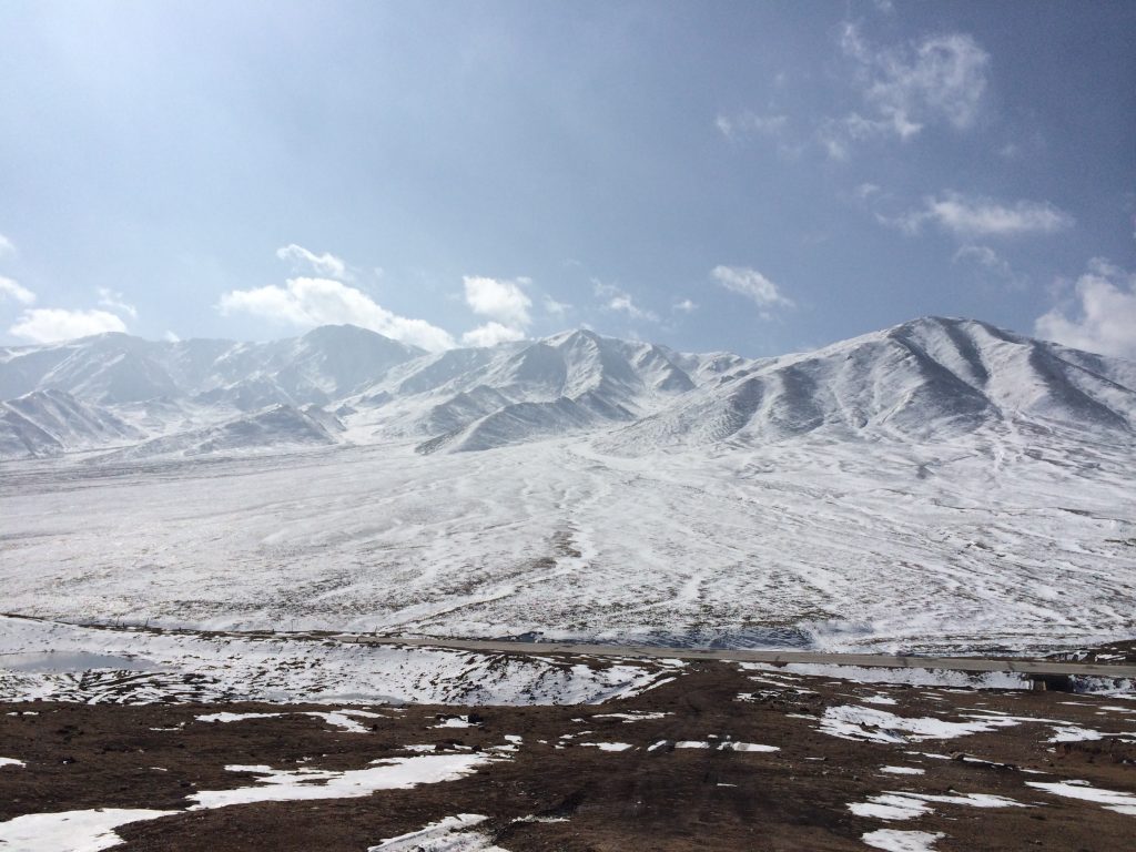
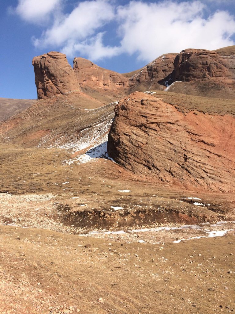
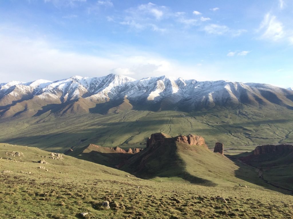
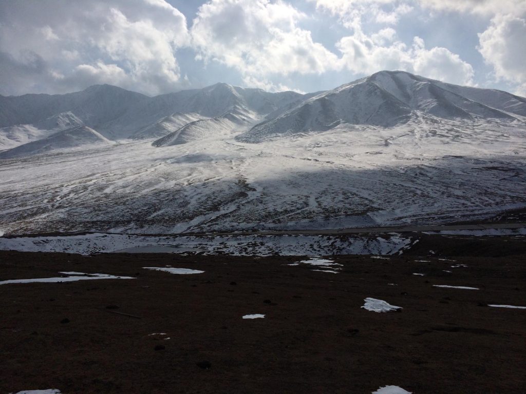
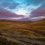
The actual Laji Mountain is a 14,000 foot (4,260 m) mountain that is mostly a nice walk up on foot but the last few hundred vertical meters involves quite a bit of loose scree and some tricky sections that might involve good balance a top some precipitous rocks. You certainly don’t need any ropes or special equipment to climb this, but I wouldn’t recommend climbing to the summit if you were a beginner hiker. You would have to be a pretty experienced, confident trekker to make your way to the top of this granite beast. The mountain we actually hike (and what we are referring to as “Laji Shan”) and generally take groups to for a one day team building activity is off the shoulder of this larger parent mountain. This sub-mountain is more of a dominant ridge that is covered in grassy slopes and the occasional rocky outcropping. But even though the mountain we hike with most of our groups is not quite as advanced or technical as the actual Laji Shan, it is still an excellent challenge and the hike passes several imposing red rock cliffs that are each represent about 50 meters of vertical relief. In fact, if the red sandstone here was not so loose, these cliffs would make for excellent rock climbing.
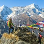
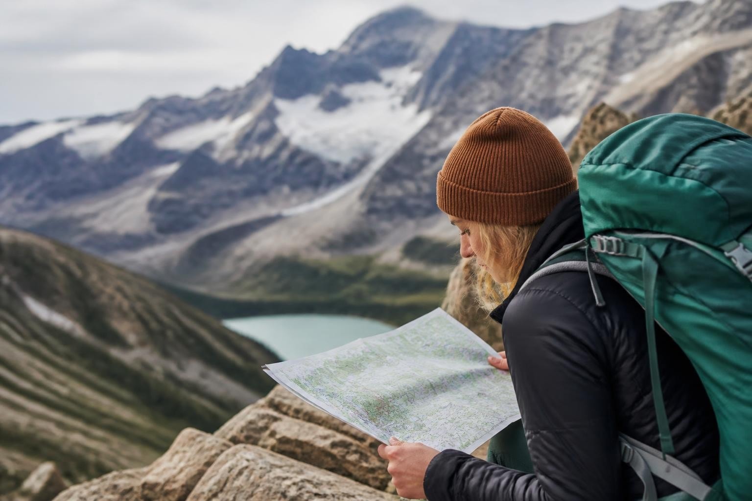
Laji Shan makes for a great destination, whether you want just to picnic in the grasslands with your family at the bottom of the mountain or challenge yourself and make it to the top for an excellent view of prayer flags and granite peaks. The actual hike to the ridgeline summit takes about 2.5 hours up and 1 hour down for a person of average fitness. The hiking here is not too terribly difficult but the the altitude will definitely leave you short of breath. Make sure you take your time as you ascend and take lots of breaks and drink lots of water. As the hike is 100% exposed above tree line, there are no trees here for shade or shelter so make sure you have lots of sunscreen for the intense high altitude sun. If on the rare occasion, there is a chance of lightning danger, please be safe and do not summit the ridge as you will be the highest thing for miles with no place to escape a lightning strike.
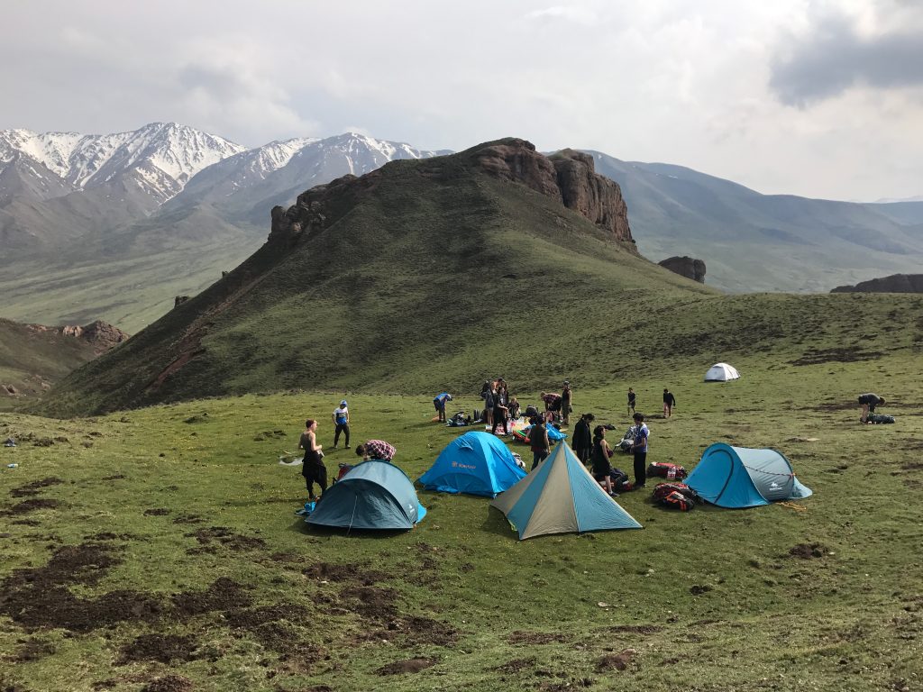
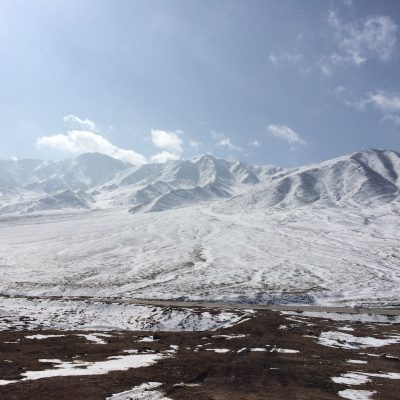
The hike starts out in a river valley at 11,810 feet (3,600 meters) that flows between two spectacular red rock cliffs. You walk in the valley between the cliffs and then continue to make your way through this corridor right behind the cliffs to the high grassy ridgeline at 13,123 feet (4,000 meters). To hike this ridge you start at the trailhead and, on a clear day, just look up at the highest peak and walk in that direction towards the top. As with most hikes on the Tibetan Plateau, the landscape is vast and open and there is no real hiking trail here; you are just following the livestock trails of sheep and yaks that make their daily commute up the mountain as they search for “greener pastures”. About half way up the hike (about 45 minutes from the trailhead) there is a terrific little green saddle tucked behind one of the red rock formations. This makes a great place to set out a tent and has an incredible view at sunrise overlooking the red rock cliff tops across the valley to the actual 14,000 foot Laji Mountain peak. So you could also camp up here for a night and on our 4 night/ 5 day Red Rocks and Monasteries trip we actually do camp on top of this beautiful spot.
To see a testimony from one of our recent clients on the Red Rocks and Monasteries trip, in partnership with the Hutong, see here.
Above is our 4 night/ 5 day trip exploring Laji Shan, Kanbula National Park, and the Rebkong LongWu Monastery
Getting to and from Laji Shan
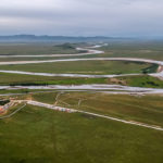
To make it to Laji Shan, you head in the direction of Guide 贵德 south from Xining on the S113. As you are leaving Xining, you will pass Kumbum Monastery, or Taer Si 塔尔寺 about 26km south of Xining. Kumbum Monastery is about 1/3 of the distance to Laji Shan, so if you pass the exit to this monastery you know are going in the right direction. There is a large toll both you will need to pass through just before Kumbum Monastery and the toll is generally 10 RMB for a normal size car. After this toll gate you will drive about another 20 minutes up the mountain. Right before you get to the toll gate for the tunnel that goes through to Guide 贵德 you take a right up the hill that leads to Qinghai Lake 青海湖and Sun and Moon Mountain 日月山 (so you are NOT entering the toll gate for the tunnel, but going the old scenic way up and over the mountain). This will start you on a winding two lane road that switchbacks to a high pass at 12,467 feet (3,800 meters). On top of this pass there is a small monastery that is worth stopping in for 30 minutes and then you continue on your way down the mountain. As you descend the pass into the grasslands you veer left on a sharp curve and about 5 minutes after this curve you can pull over at the trailhead at the bottom of the red rock formations.
There are no public buses that travel beyond Kumbum Monastery up this remote side road, so you will need to hire a car for the day, or you can contact us about arranging a driver and guide for the day.
To see a map of Laji Shan in Qinghai Province click here (note the altitudes listed are slightly wrong but this will give you accurate GPS coordinates)
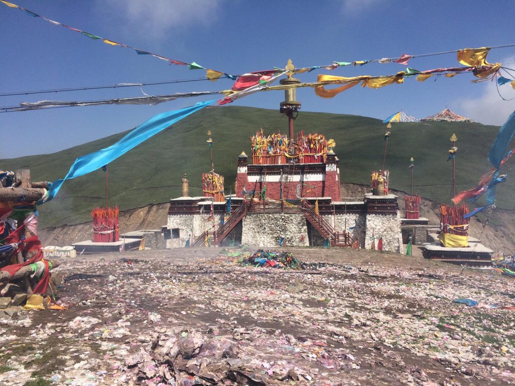
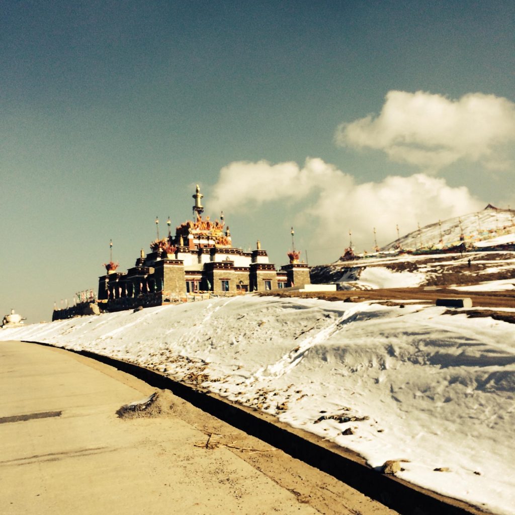
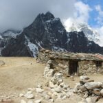
The Laji Monastery
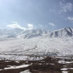
Just a 10 minute drive before you reach the day hike to Laji Shan you will cross a 3,800 meter pass with a small stone monastery. This small Tibetan Buddhist monastery only has 3-4 monks that practice here, so you will only need a few minutes to see the monastery. To enter the monastery there is a 20 RMB ticket fee per adult and small children are free. The monastery worships the deity that lives on the highest point in Qinghai Province, Amnye Machen, at 6,282 meters.
In the last 2 years, tourism has increased at this little monastery and there now 15-20 vendors that sell various Tibetan trinkets including scarves, caterpillar fungus, and oxygen bottles for those coming from see level. The parking lot here in July and August can be a little busy but once you walk up the steep stairs into the monastery, it is quite calm and refreshing. Walk around the little monastery complex and you will come to a brilliant array of prayer flags stretched across the mountain and this little hike (and even going past the wooden stairs into the grass) is definitely worth doing and is pretty far from the crowds of the parking lot.